
Tees Barrage Virtual Running Routes
|
|
Tees Barrage Virtual Running Routes |
|
Follow this link for an introduction to Virtual Running Routes.
Location
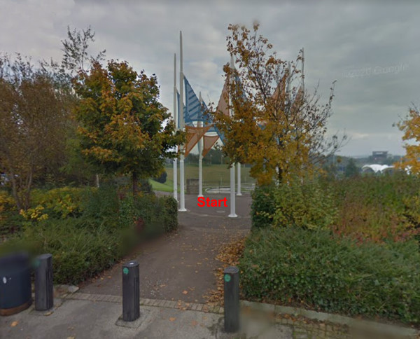
The Start is in the ring of flagpoles on the north side of the Tees Barage White Water course. The What3words reference is ///curiosity.outsmart.rapid.
Click on the link to see a map. You can zoom in (and, optionally, switch to Satellite mode) to see the details of the final approach to the event. You can also get directions if you put in your starting location.
Park in the Tees Barrage public car park situated next to the Talpore Premier Inn, Whitewater Way, Stockton TS17 6QB.
Routes
The Long version of the route goes through the Tees Barrage area, together with an area of new housing and Durham University's Stockton campus. The area is very flat, and there is no significant climb on the route.
The short version of the route remains close to the Tees Barrage and is fully accessible. It involves virtually no climbing.
In the MapRun6 app, Select Event, navigate to UK / Cleveland / Stockton and then choose one of the two routes.
| Route | Length | Name in MapRun6 | |
| Short | 1.2 km | Tees Barrage Short | |
| Long | 2.9 km | Tees Barrage Long | Temporarily unavailable due to construction work. |
Click on a route name to see a printable image of the route map.
Please note that the route lengths are measured in straight lines between the checkpoints. Unless you can leap over tall buildings (and the River Tees!) in a single bound you'll actually run about 30% - 50% further than the distances in the table.
Results
You can access the results via the MapRun Console. Open the menu (three horizontal lines at the top left hand corner of the window), select Leader Board and then filter by Tees.
Facilities
There are no public toilets in this area, so please make your own arrangements beforehand.
Safety
Please:-
Any questions?
Contact Caroline Mackenzie via 07973-870529.
Go to the CLOK home page